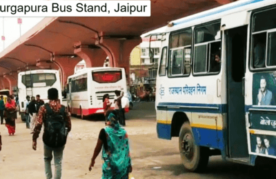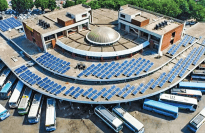
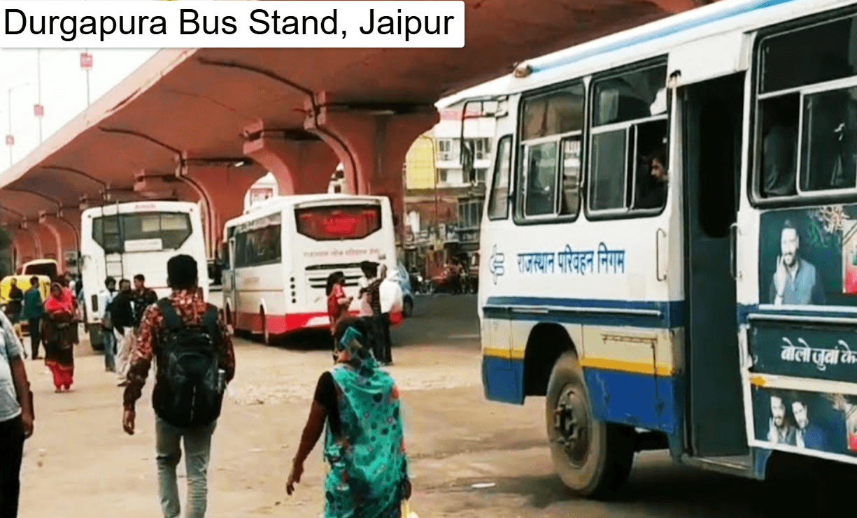
Durgapura Bus Stand is one of Jaipur’s key bus stands. It serves the southern side of the city, around Tonk Road, Gopalpura Bypass and the Durgapura neighbourhood. It works mainly as a local transit point with some regional connections. The bus stand is also near Durgapura Railway Station, so it is often named as one of the closest bus stands to the station. That makes it handy if you are switching between train and bus.
It also takes some pressure off the busier Sindhi Camp terminal. RSRTC officials recently inspected Sindhi Camp, Transport Nagar and Durgapura together, which shows how the three function as a connected network.
Durgapura Bus Stand: Detailed Overview
| Detail | Information |
|---|---|
| Name | Durgapura Bus Stand |
| City | Jaipur, Rajasthan |
| Area | Durgapura, near Gopalpura Bypass / Tonk Road |
| Operator | RSRTC and city bus services |
| Type | Local and regional bus stand |
| Nearest railway station | Durgapura Railway Station |
| Best for | City travel, nearby towns, rail-bus transfers |
Timings and schedules change, so confirm them on the RSRTC website or at the enquiry counter.
Bus Terminal Info
The terminal handles both city buses and some regional buses. Boarding areas are divided by route, and display boards and staff help with platform directions. Peak hours are early morning and evening, when office-goers, students and weekend travellers fill the platforms.
Facilities
You can expect the standard facilities of a government bus stand:
- Covered waiting areas and seating
- Drinking water and restrooms
- Ticket and enquiry counters
- Small food stalls and tea shops
- Auto-rickshaw and cab pickup points
Facilities vary over time, so carry water and a snack for long waits. Official reviews also regularly flag upgrades such as shaded seating.
Bus Depot and Operations Centre
RSRTC runs one of India’s larger state bus networks, with around 2,230 routes and a fleet of about 4,500 buses. Durgapura works as part of this system, handling bus dispatch, driver and conductor reporting, route coordination and basic vehicle upkeep. Buses on city routes and regional services run through coordinated schedules.
Full Route Map and Major Destinations
From Durgapura, buses typically connect to these areas:
- Central Jaipur: Sindhi Camp, Ajmeri Gate, Chandpole and Choti Chaupar
- Old City attractions: Hawa Mahal, City Palace and Govind Dev Ji Temple
- Southern Jaipur: Sanganer, Tonk Road, Mansarovar and Jagatpura
- Nearby towns: Tonk, Sawai Madhopur and other southern Rajasthan routes
- Long-distance travel: Connections via Sindhi Camp or Transport Nagar to Delhi, Agra, Ajmer, Udaipur and beyond
For example, a trip from Durgapura to Govind Dev Ji Temple by city bus takes roughly 46 minutes and costs ₹25–40, with services running about every 10 minutes. A taxi covers the same road distance of about 10 km much faster.
Route Direction Map
Durgapura lies south of the Old City. Heading north along Tonk Road takes you towards Gopalpura, Jawahar Circle’s side of town and the Pink City. Heading east or west connects you to Mahaveer Nagar, Sanganer and the airport side. Check Google Maps or the RSRTC route chart for live directions, since road diversions and metro construction can change routes.
City Connectivity from Jaipur
City buses run through JCTSL and RSRTC. Jaipur’s city bus network includes radial, circular, AC and suburban routes. Beyond buses, Durgapura connects through:
- Rail: Durgapura Railway Station is nearby
- Auto-rickshaws and app cabs: Good for last-mile travel
- Metro: Check current Jaipur Metro extension plans for updates
Why Is Durgapura Bus Stand Famous?
- It is conveniently placed on the Tonk Road corridor, one of Jaipur’s busiest.
- It is close to a railway station, colleges, markets and residential colonies.
- It offers frequent, affordable city bus connections.
- It reduces dependence on the crowded Sindhi Camp terminal.
Benefits
- Affordable: City bus fares are very low compared with taxis.
- Well connected: Easy access to tourist spots, markets and rail links.
- Less crowded: Generally calmer than the main central terminal.
- Practical for locals: Suits daily commuters and students.
- Good transfer point: Simple connections between bus, train and cab.
Travel Tips for Passengers
- Reach 20–30 minutes early during peak hours and festivals.
- Keep small change for city bus fares.
- Check route numbers on the bus front and confirm with the conductor.
- Book long-distance seats in advance through RSRTC or authorised partners.
- Watch your belongings and avoid unofficial ticket sellers.
- Use official enquiry counters for accurate timings.
- Travelling with luggage? Consider a cab for the last stretch.
FAQ
Where is Durgapura Bus Stand located?
In the Durgapura area of Jaipur, near Gopalpura Bypass and close to Durgapura Railway Station.
Is it close to Durgapura Railway Station?
Yes, it is listed among the closest prominent bus stands to the station.
Can I reach Hawa Mahal or City Palace from here?
Yes. Take a city bus towards Ajmeri Gate or Choti Chaupar and walk or take an auto from there.
Does it run long-distance buses?
Mostly local and regional services. For long-distance routes, Sindhi Camp and Transport Nagar are the main terminals.
How do I check timings?
Use the RSRTC website, the enquiry counter at the stand, or a booking partner such as redBus.
Is it safe at night?
Generally yes, but stay in lit, busy areas and use prepaid or app-based cabs late at night.